There’s a story in my husband’s family that dates back to when John’s father still lived. There was nothing that appealed to him more than a Sunday afternoon drive. One afternoon he asked local neighbors Gary and Maxine to join his wife and him for a ride to get some burgers. When they were 30 miles south of Stevens Point, Gary turned to his friend and asked, “Where are we going?†The answer lay one-and-a-half hours south at Monk’s Bar & Grill, located in the city of Wisconsin Dells.
“You never knew where you’d end up when your dad was driving,†John’s mom said.
One time one of his car trips landed John’s parents in Canada, long before the days you needed a passport to cross over the U.S.-Canadian border.
We repeated his parents’ journey to Wisconsin Dells while we were visiting John’s mother earlier this month, all the way down to Monk’s, where we had burgers and fries.

Most people who visit Wisconsin Dells associate it with theme parks and boat rides, gift and souvenir shops, Ripley’s Believe It or Not! Museum, Tommy Bartlett’s Water Show, too many sweet foods to describe, and countless amusements.

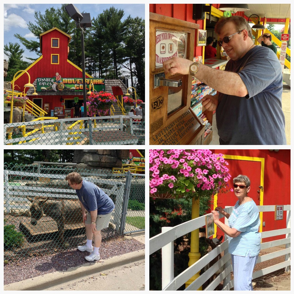
If you visit “the Dells†over a summer weekend, be prepared to bring your wallet, for everything has a price unless you just want to look through the shopfront windows. John and I visited the Dells for a day with his mom, so we took in only a fraction of what the area has to offer. We played mini golf at Timber Falls Adventure Golf, taking time to feed the donkeys and goats, and flattening a penny to take home as a souvenir.
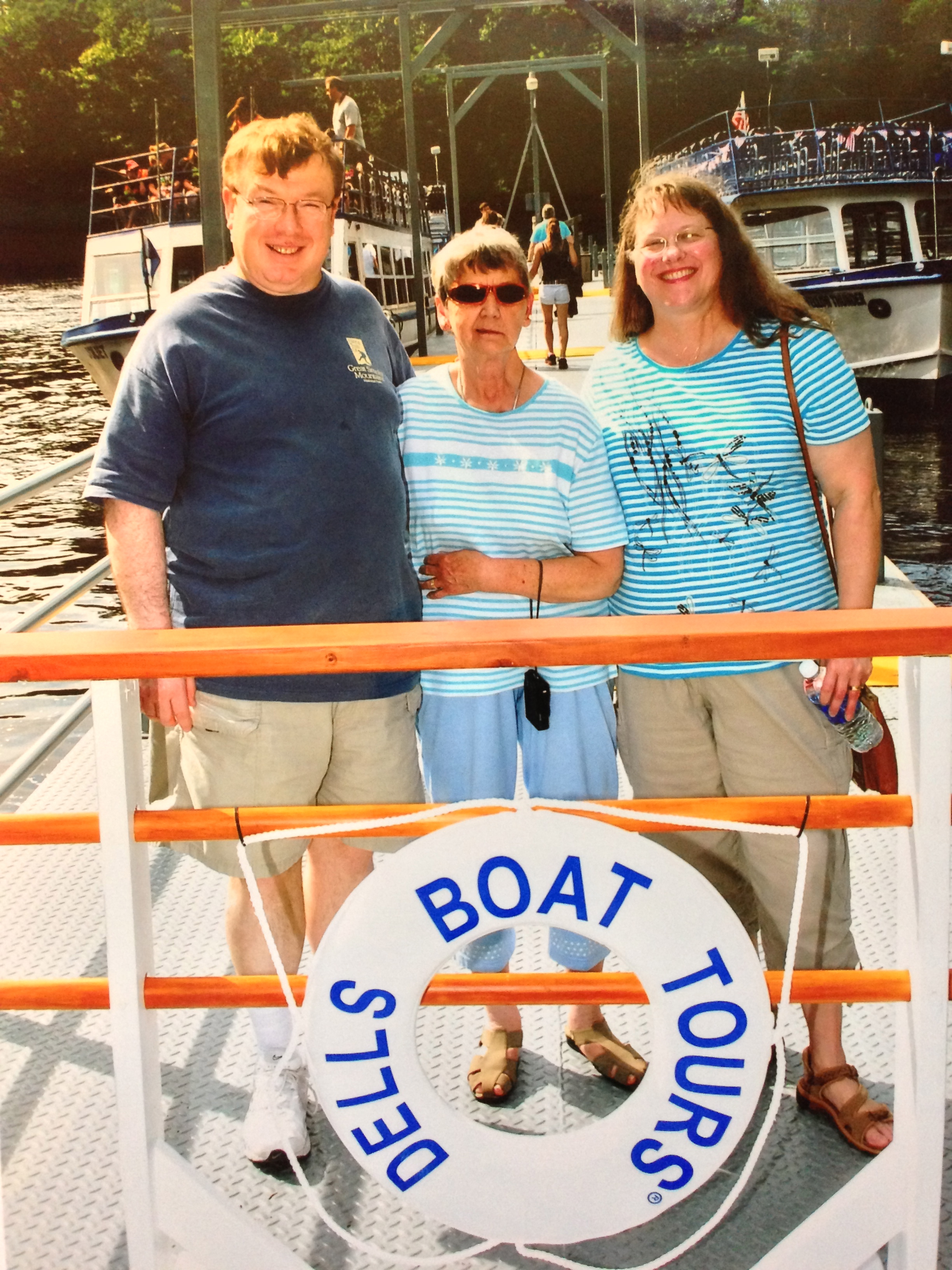
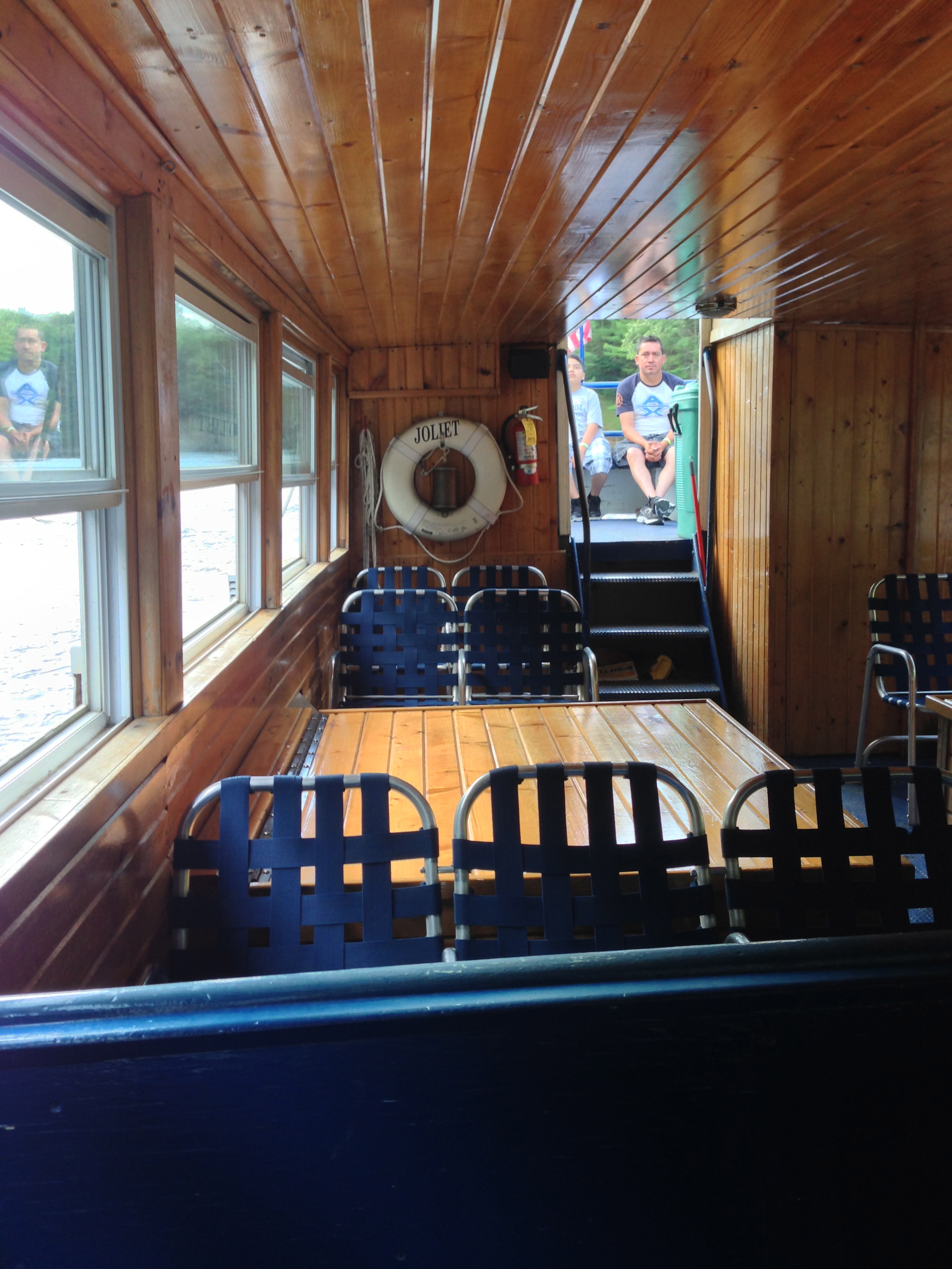
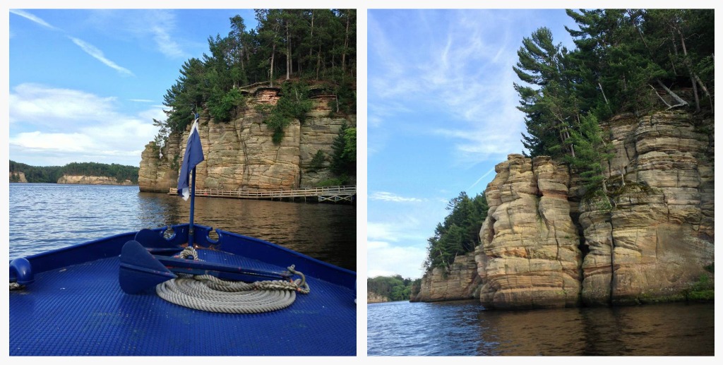
The highlight of our day, however, was exploring a 10-mile stretch of the Upper Dells of the Wisconsin River on a two-hour Dells Boat Tours ride. At 435 miles, the Wisconsin River is the longest river in the state and, according to the brochure that Ken the boat pilot and his assistant, Madison, sold us, is considered one of the hardest working rivers in the world, with six flood control dams and 21 hydroelectric dams along its route. While there is no doubt that a Dells Boat Tour is a commercial venture run by the Wisconsin Department of Natural Resources, it follows the tradition of the original river pilot and guide, LeRoy Gates, a raftsman who charged visitors a fee for guiding them through the Narrows of the Upper Dells while they rowed and he talked. Gates, who wore a top hat and a dress coat, ran his business successfully for nine years. That spirit of enterprise is alive and well today from the moment you get your photo snapped before you board a tour boat to when you exit the boat and collect a package of photographs for a fee at the same location.
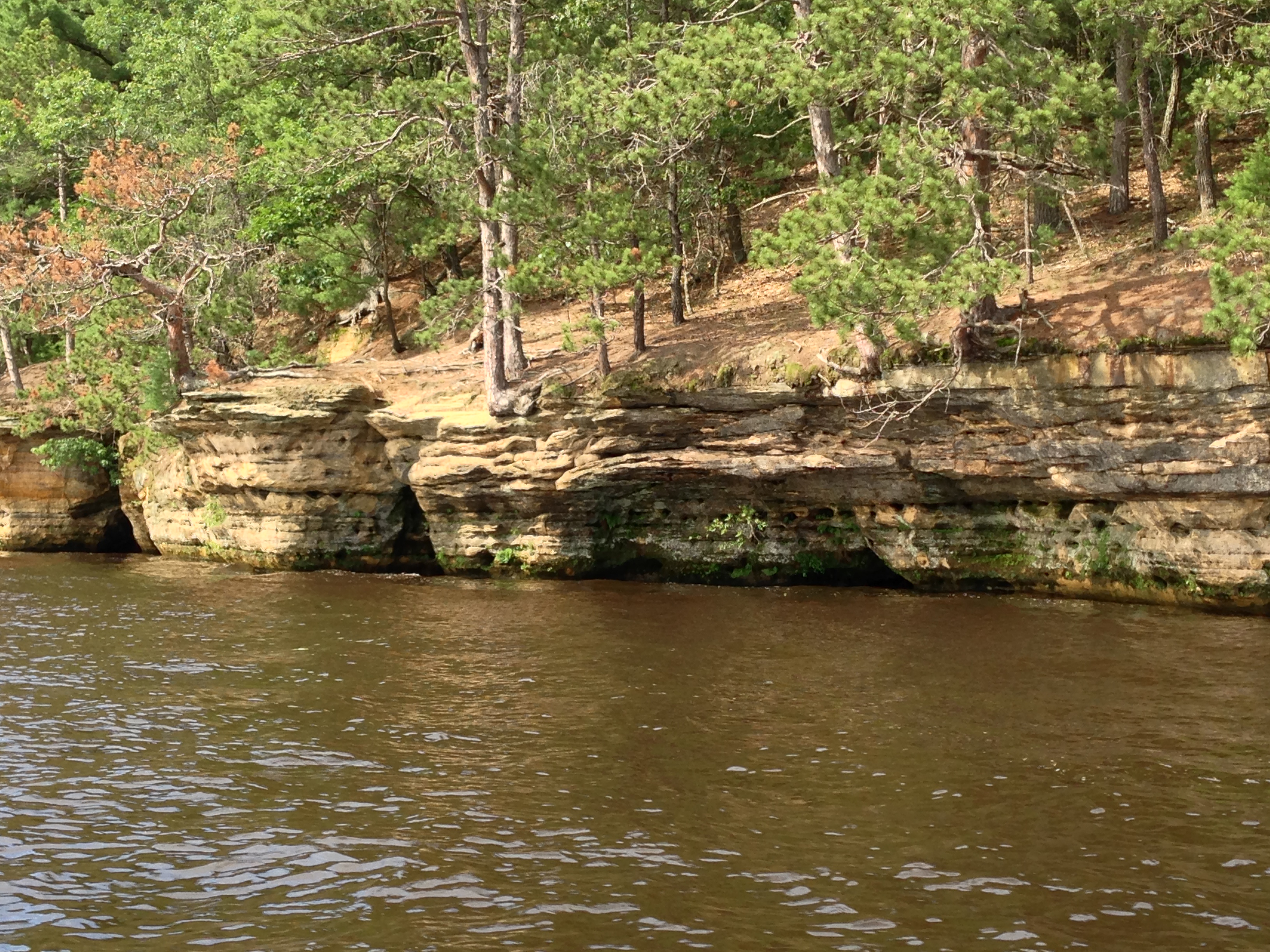
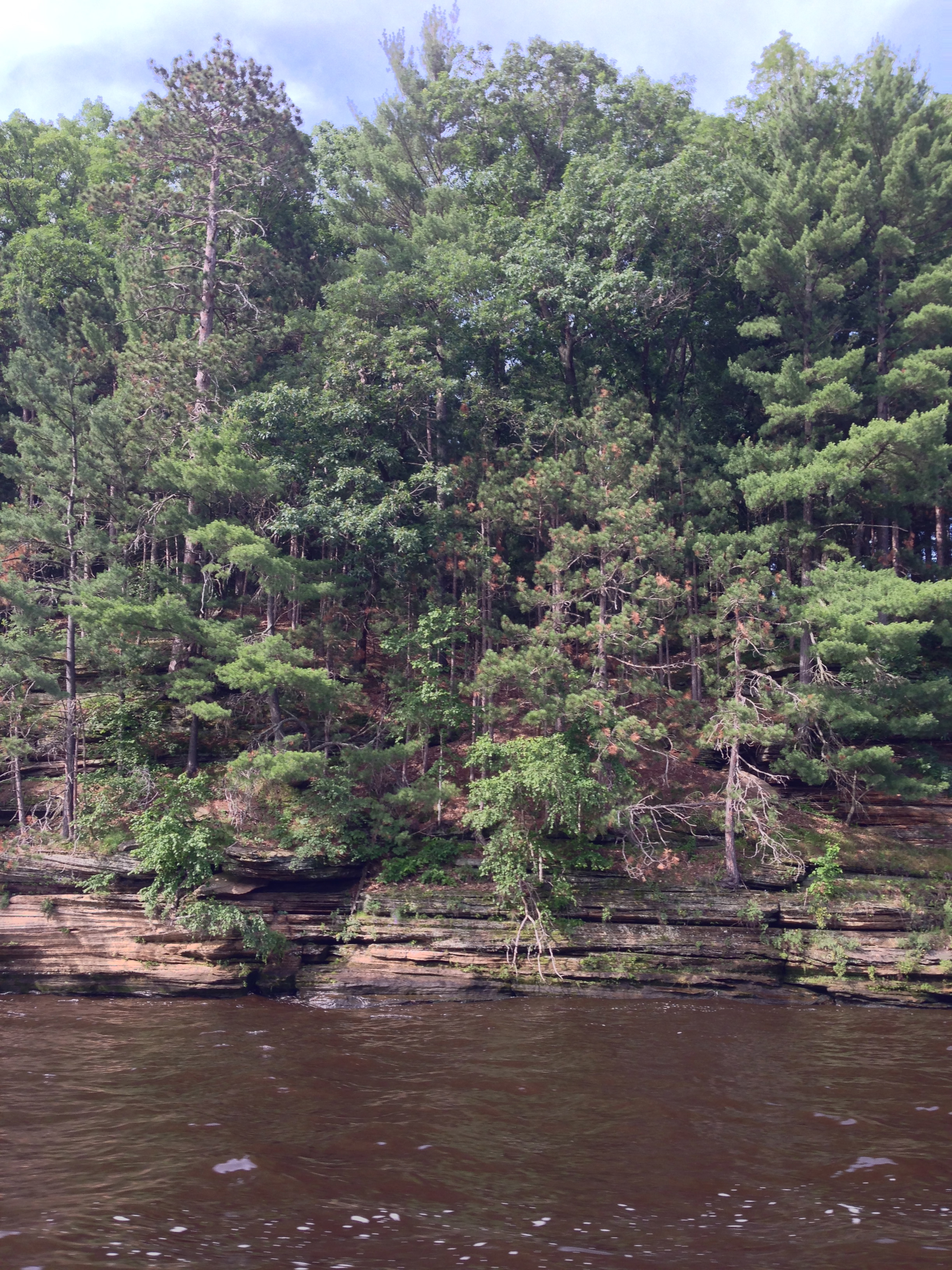
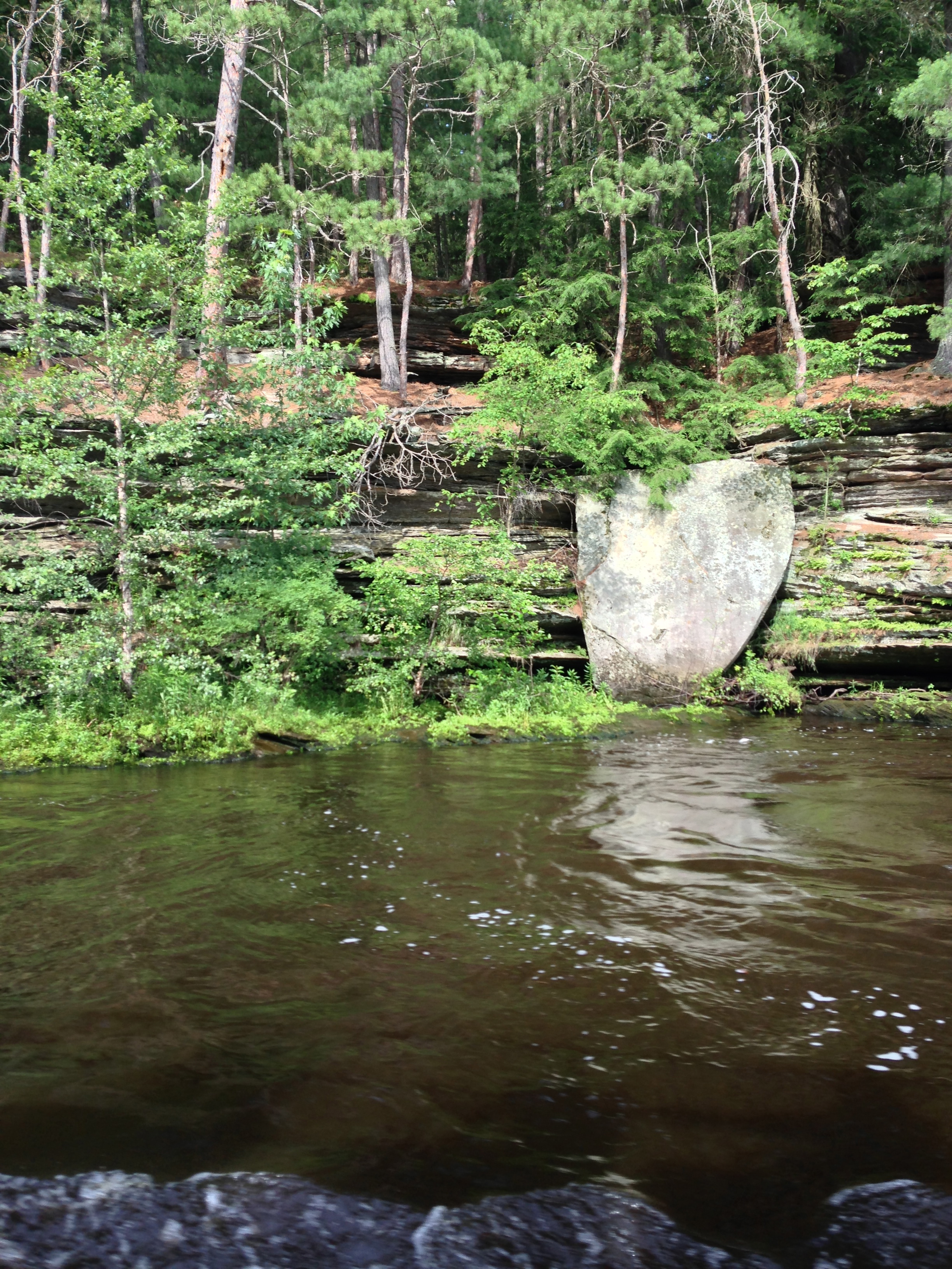
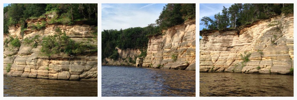
The Upper Dells is noted for its scenic beauty, with outcroppings of sandstone cliffs and narrow canyons. The Wisconsin Dells are one of only four places in the world—New York, Switzerland, Germany and Wisconsin—where you’ll find this type of sandstone that is so soft and porous that tree roots can grow 40 to 50 feet inside it before they locate water to nourish the rest of the tree. Bank swallows from Venezuela migrate each year to the cliffs to dig nests into their sides. The sandstone represents bedrock from the Cambrian period over 500 million years ago, when much of the planet was covered by desert. The word “dells†originates from the French word, dalles, a description of the flat, layered, or slab-like characteristics of the sandstone.
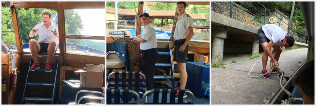
Much of what we learned about the Wisconsin Dells was narrated by Madison, a first-year student at the University of Wisconsin-Steven Point. This is his third summer as a tour guide, and he told us how much he loves his work.
“I even get to drive the boat sometimes,†he said.
Madison pointed out that though the water of the Wisconsin River looks dirty, it is actually very clean. The river is colored brown by the tannic acid found in the bark and roots of tamarisk and oak trees floating down the river coming from northern Wisconsin and Michigan. Native Americans used to rub tannic acid on animal skins to tan or preserve them.
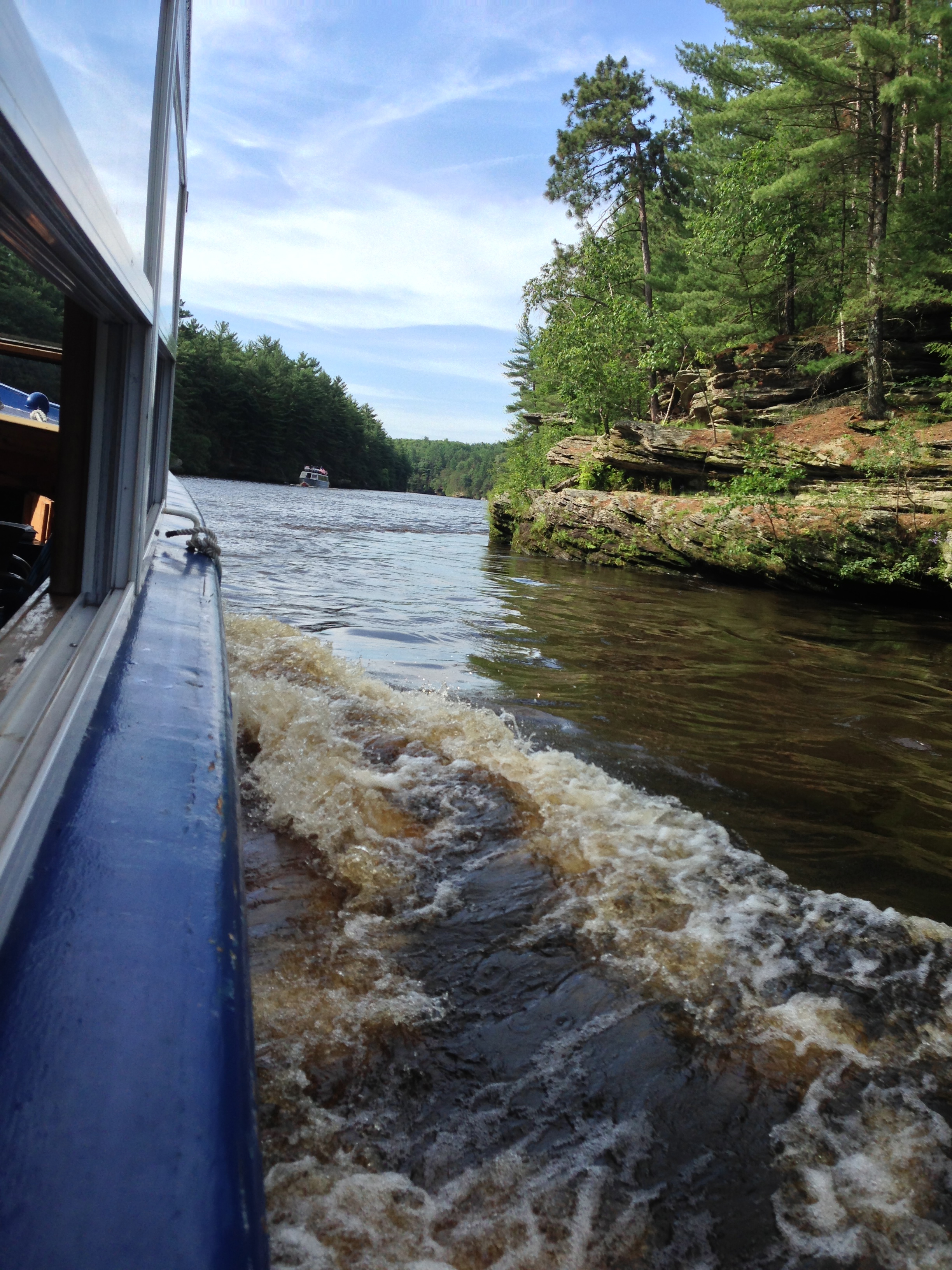
When you take one of the Dells Boat Tours, you are taking a trip back into time as the river pilot tells tales of the Upper Dells. About 14,000 years ago, a large ice lake gave way, allowing the glacial waters of Wisconsin to flood through the area, cutting out gorges and leaving behind cliffs. These gorges formed the Narrows, treacherous areas where the Wisconsin River narrowed to only 52 feet and the water was so shallow that it formed deadly rapids and swirling whirlpools where a man could drown if he was pulled under. In the mid 1800s, lumberjacks floated logs down the Wisconsin River every spring on rafts to the sawmills north of the Wisconsin Dells; a number of them lost their lives along the way. My husband’s great-grandfather, Edward John Nolan, in fact, was one of these lumberjacks. By the end of the 19th century the railroad replaced rafts for transporting logs to the sawmills. When the first permanent dam was built in 1909, it raised the level of the river about 20 feet and decreased the dangers of the Narrows at the same time.
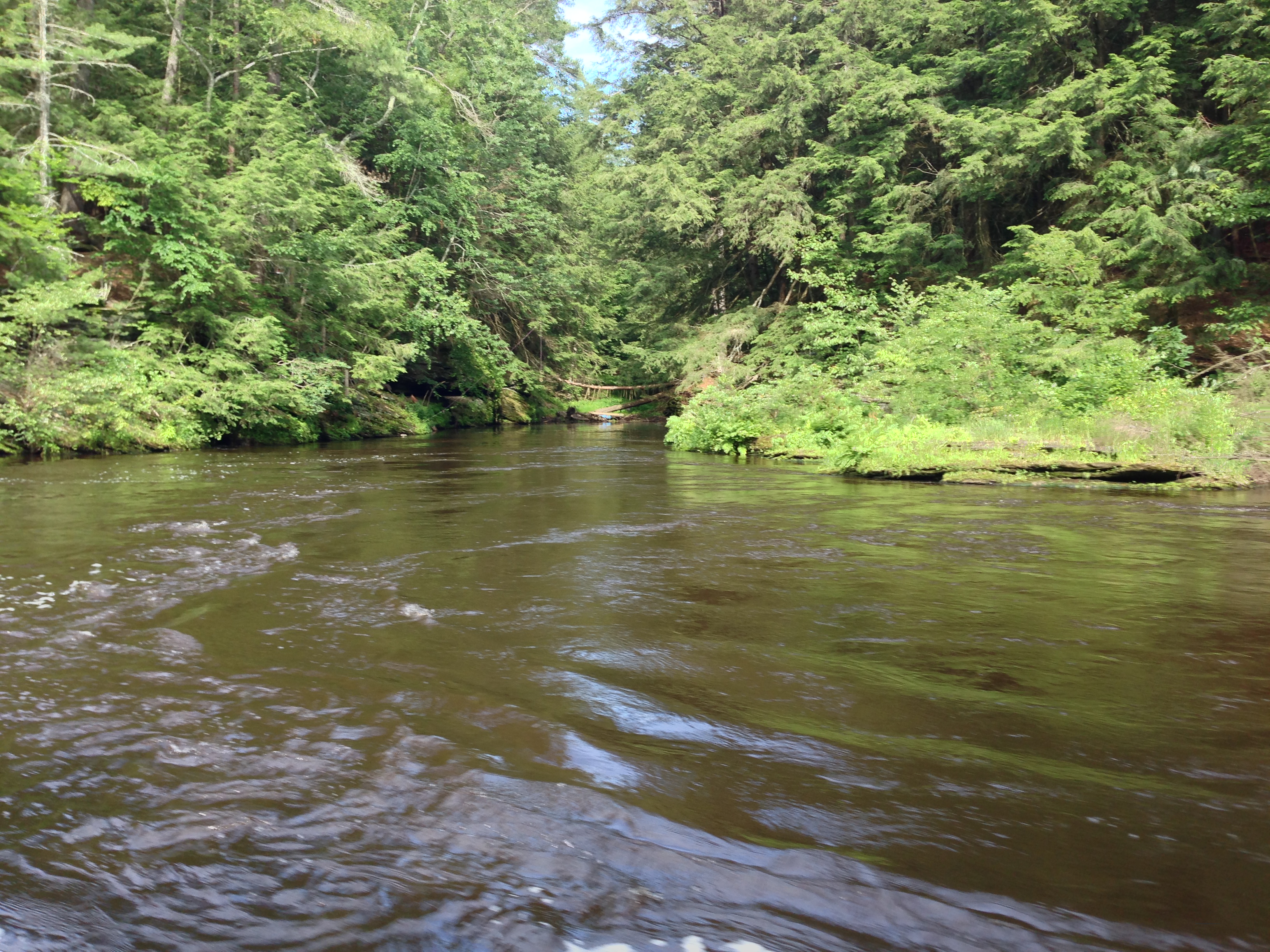
Native Americans tell their own story of how the Dells formed. Long ago their fathers lived far away and were starving. They prayed for guidance in the grotto of the Green Dragon, and sent the dragon on a journey to find a solution. The Green Dragon arrived in the Land of Ice and Snow, where he could find no food. His heart was so heavy that he stopped to rest, and the beating of his heart was so loud that it carved grooves in the earth where he lay. The Green Dragon crept south, and as he did so, the ice melted and his tail left behind channels of water. Where he clawed his way forward, water filled the impressions and formed lakes. As he traveled, the dragon spat out the game he had eaten before his journey—deer, bear, turkey and sturgeon—and the green quills from his body fell off onto the rocks, forming the seeds of a forest. The banks of the river are forested with hemlocks, and white and red pines.
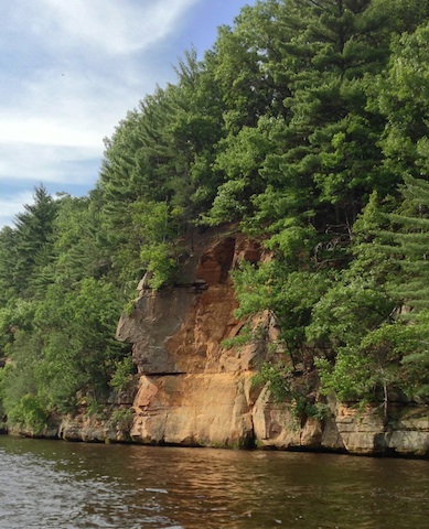
There are many Native American tales associated with the Wisconsin Dells. One of the rock formations along the river is know as Black Hawk’s Profile, not because his tribe dwelled there, but because the leader and warrior of the Sauk and Fox Indians fled to the area to hide after a terrible battle at Bad Axe River in 1832. Legend tells that Black Hawk leaped across the Wisconsin River at its narrowest point to escape his pursuers. This 52-foot-wide stretch of the river is called Black Hawk’s Leap.
All of the boats that are part of the Dells Boat Tours fleet are named for historical figures who played a role in the Wisconsin Dells area. Our boat was named the Joliet in memory of Father Jacques Marquette and Louis Joliet, French explorers who followed the Wisconsin River to what they thought they would be the West coast but instead turned out to be the Mississippi River. From the Native Americans who guided them, these two men learned the term “Meskousing†for the river, which over time became “Ouisconsin†and eventually “Wisconsin.†The Wisconsin Historical Society believes that Wisconsin means “River of Red Stone†or “River of the Great Rock.â€
The fact that the Dells are in such great condition, historically speaking, is largely the result of the preservation efforts of a Depression-era entrepreneur named George Crandall, who said, “No one can own the Dells. He can only be a custodian for a time.†Crandall observed that the boat piers and resorts developing along the banks of the Wisconsin River were destroying the landscape of the Dells. Over time he purchased so many tracts of land in the area that he ended up owning most of it. He tore down old buildings and reforested the area. Upon his death, his heirs turned over more than 1,200 acres of Wisconsin Dells land to the Wisconsin Alumni Research Foundation with the stipulation that it be kept in its natural state. Today that same land is owned by the Wisconsin Department of Natural Resources, which allows only limited access and has named the land a “State Natural Area.â€
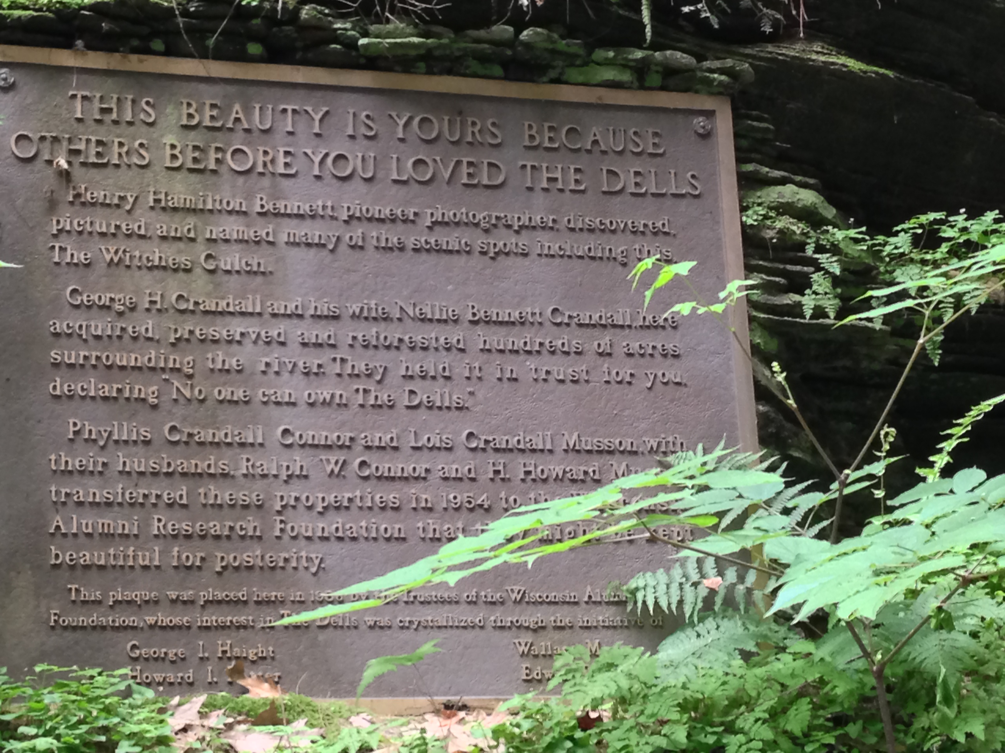
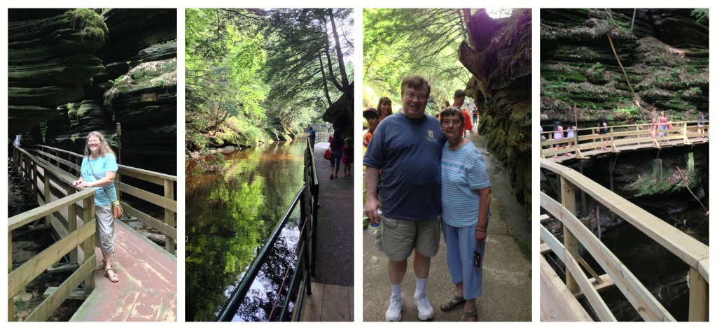
Passengers of Dells Boat Tours disembark at two points on their journey, one of which is Witches Gulch, a gorge through which a trout stream flows and continues to carve new patterns into the sandstone. Prior to the mid-1800s, access to the area was blocked by debris and a waterfall. However, a clever photographer named Henry Hamilton Bennett visited the Gulch during winter on ice skates, and chiseled his way through. Eventually he partnered with a local steamboat captain to build walkways into the area that have been in use (and of course updated) since 1875. When you visit Witches Gulch today, you use a boardwalk that tunnels through the openings in the cliffs. The sandstone is cool and damp to the touch, and the rock formations are awe-inspiring.
The second place where your tour boat docks is along the shoreline where Stand Rock is located, a flat slab of rock that is impaled on a 47-foot-tall layered sandstone pedestal. Stand Rock is the most famous of all the rock formations in the Dells, immortalized by H. H. Bennett when he snapped a photo of his son, Ashley, in mid-air as he jumped a five-foot gap from a cliff to the top of Stand Rock. Bennett, the inventor of stop action photography, asked his son to jump the gap 17 times before he achieved the shot that earned first place in a national photography contest held in New York. Bennett, who moved to the area and became enamoured of the Dells, bought a tintype photography studio from the river tour guide, Leroy Gates. Over the years, he photographed the Wisconsin Dells frequently, which brought visitors to the area. He also befriended the local Ho-Chunk Indians and photographed them, documenting their culture.
Until the 1940s, when insurance companies expressed concerns, visitors reenacted the jump between the cliff and Stand Rock that Bennett’s son made. Today trained dogs make the jump instead, with a safety net below. While we were there, we observed a German shepherd in action.
At the Stand Rock shore landing are interesting rock formations, among them Visor Ledge, where descendants of the Ho-Chunk danced Native American ceremonial dances.
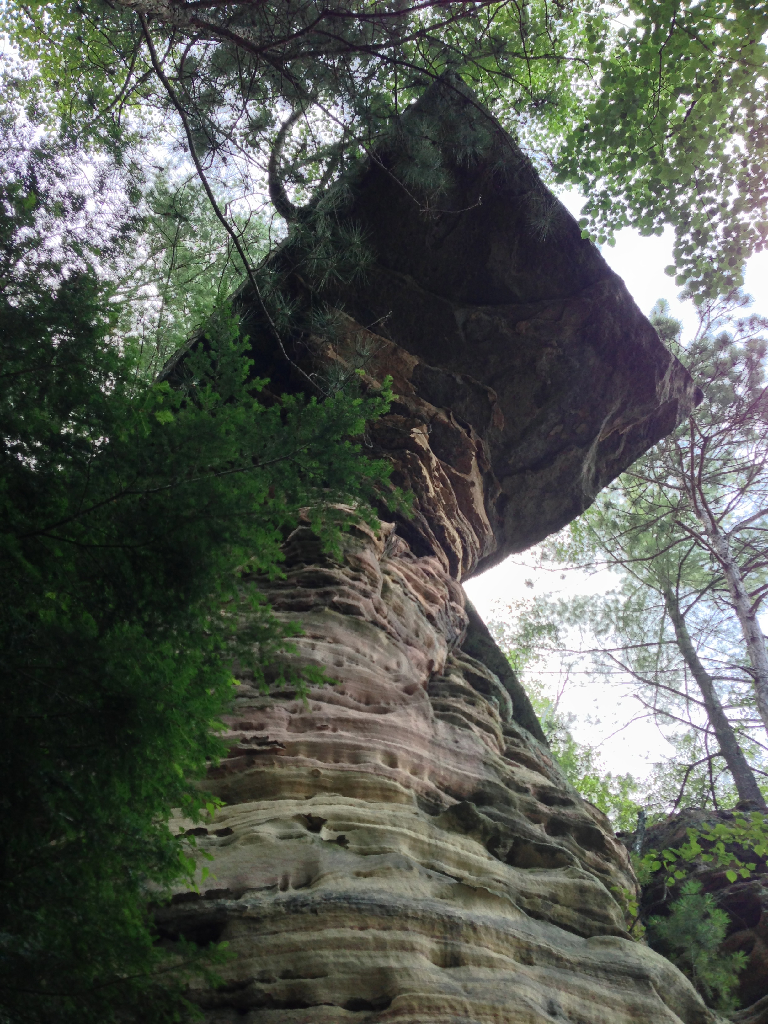
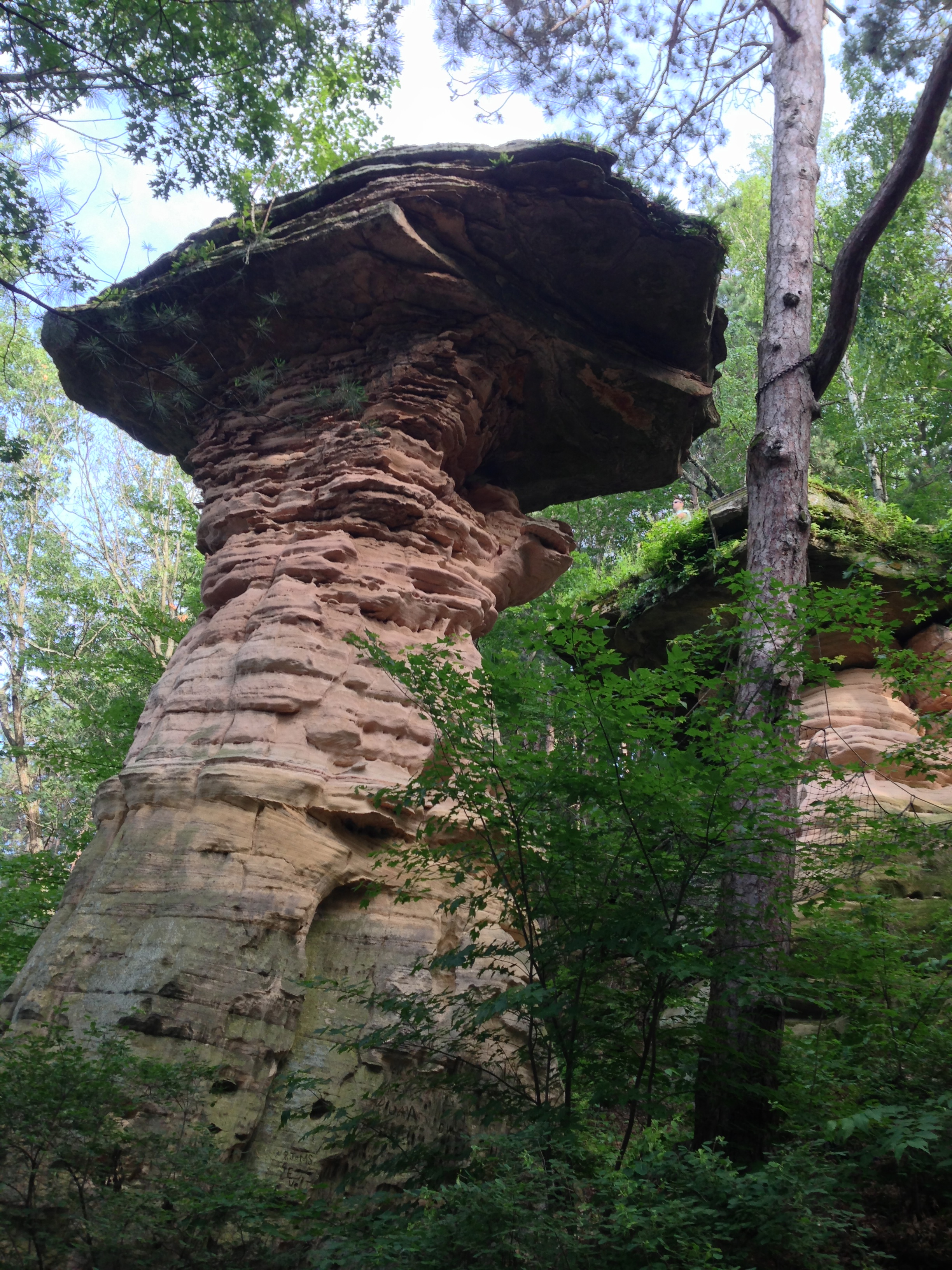
Many of the famous sandstone formations were named by Bennett, who sold the images on post cards. Among the formations is the Junior Chimney (shown below), which is a smaller version of the second-most photographed formation, Chimney Rock. Both resemble the stick-and-mortar chimneys used by pioneers.
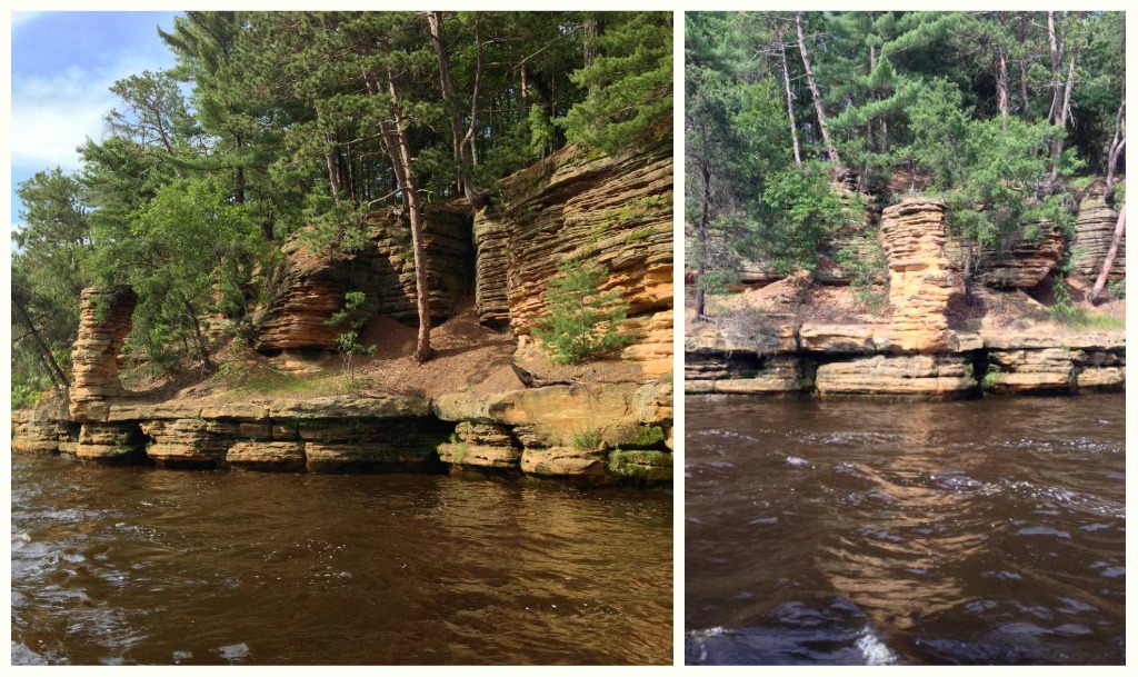
In 1938 the water crested four feet above the top of Giant’s Shield, which looks like a warrior’s shield.
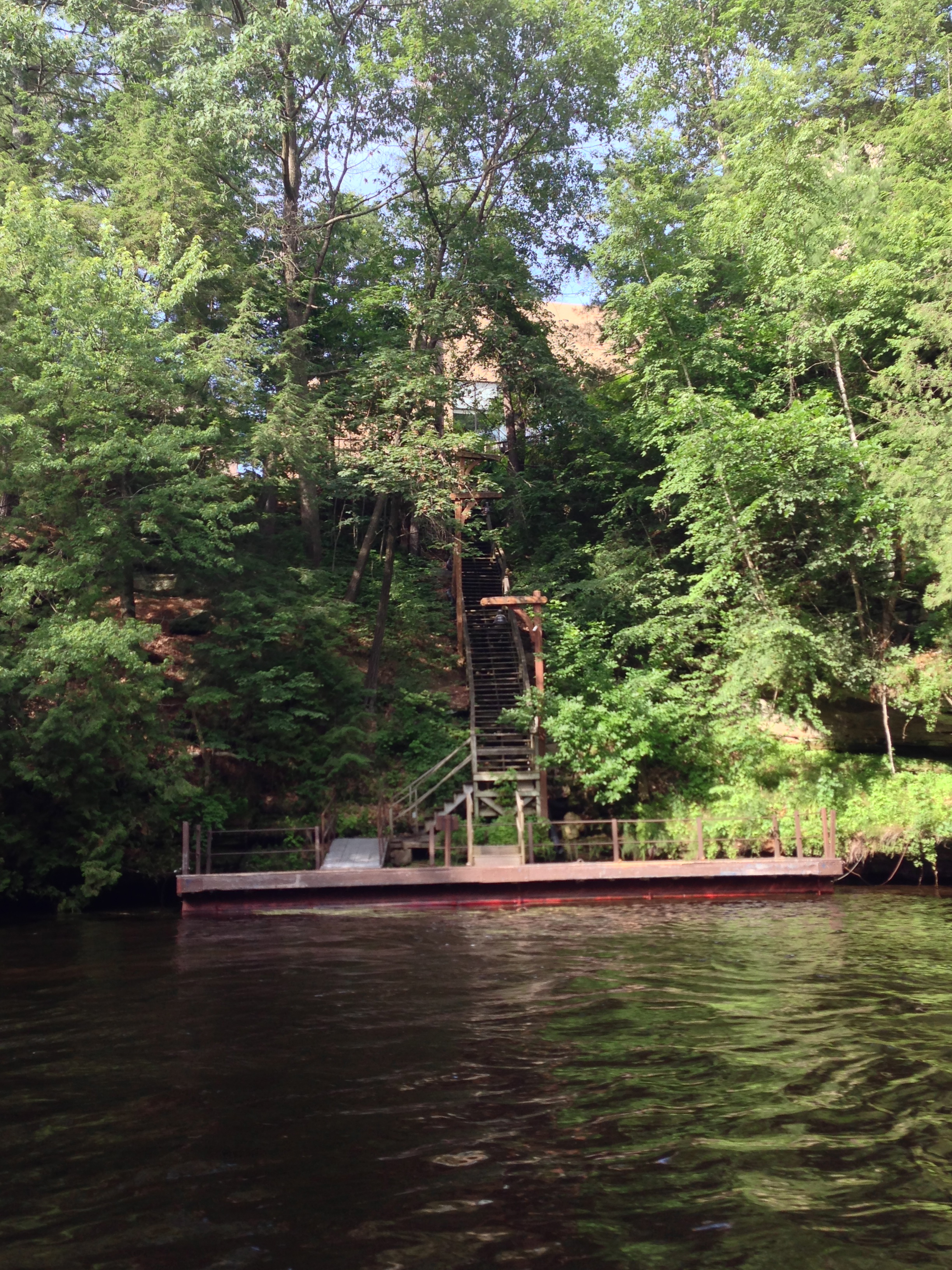
The last remaining resort built along the shores of the Upper Dells is Chula Vista, which is Spanish for “beautiful view.†You can see the stairs leading to the resort in this photo.
The name of the Sunset Cliffs speaks for itself. You can imagine what they look like at sunset, with the light glinting off them.
At the head of the Upper Dells are sandstone cliffs called the Palisades, which were named after the Palisades of the Hudson River that borders New York and New Jersey. If you look at them closely, you can see how they represent a picket fence, which is what a palisade actually is.
Our two-hour journey through the Upper Dells of the Wisconsin River went quickly—perhaps too much so—but was thoroughly enjoyable and provided the capstone event of our day trip. Apparently you can book a dinner cruise on one of the Dells Boat Tours. Who knows? Perhaps we will do that one day.

© 2013 Judy Nolan. All rights reserved.
I ran track in Wisconsin once and we visited the Dells. I got to see House on the Rock, but not much else. I would love to go back as it is such a beautiful place (as you’ve shown here)!